
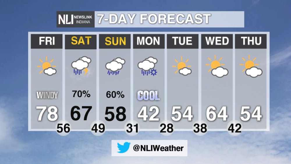
Tonight: Winds will die down to around 10-15 mph with wind gusts greater than 20 mph. After the sunsets, the temperatures will fall fast then bottoming out at 58° with very little cloud cover.

Tomorrow: Another warm day in in store, with highs reaching the upper 70's for the second day in a row. It will still be windy, getting to as high as 21 mph. But gusts will be higher at times, reaching 35-40 mph.


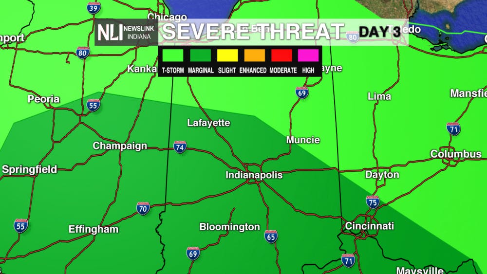
7-Day Forecast: Rain is back in the forecast, for potential severe weather on Saturday. As seen below, the SPC has the southern parts of East Central Indiana under a MARGINAL RISK for some isolated severe storms. Rain will be around throughout most of the day Saturday and then again on Sunday. After that, the temperatures will once again take a huge dive just in time for the work week on Monday.
---Weather Forecaster Ethan Rosuck
For more updates be sure to follow us on Twitter @NLIWeather.
NewsLink Indiana is a proud Ambassador for the NOAA Weather-Ready Nation program.
For more information about the Weather-Ready Nation program please click HERE
Read More

The closure of the historic Mark III Tap Room impacts Muncie’s LGBTQ+ community.
By Meghan Holt / 56 minutes agoPatrons of the oldest gay bar in Indiana reflect on how it affected their lives.

A 40-year alliance: Brian Dudley is a staple with Wapahani baseball
By Zach Carter / 1 hours agoBrian Dudley spent 40 years as the Wapahani varsity baseball coach and finished his career with an 828-320 record.

Top-seeded Cardinals’ postseason run ends with upset loss to Lindenwood
By Adam Altobella / 12 hours agoNo. 10 Ball State was upset by No. 18 Lindenwood in a five-set battle (25-20, 21-25, 25-23, 19-25, 11-15) on the Cardinals’ home court Thursday night. With how scarce at-large bids to the NCAA men’s volleyball tournament are, it is likely that the red and white’s 2024 campaign is over.
